
Field Name Book description from 1838/1839 noted by the surveyors who produced the O.S maps originally.
Baile an Alta, the town of the cliff.
- Ballynalty : J. 0’Donovan
- Ballynallta : Down Survey Maps
- Ballynaltye : Strafford’s Survey
- Ballinalty : Inq. temp. Jac. I.
In the. north side of the parish. Bounded on the N. by the parish of Cong ; E. by the td. of Bunnafollistran; S. by the td. of. Ballisnahyny;and on the W. by Gortatober td.
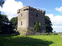
Historical & Archaeological features
Mass Rock
Description etc….

NOTE :: The mass rock is on private property , owner must give permission for access.
Inishkeeragh Crannog
MA123 030
An island, partly or wholly artificial, built up by dumping timber, earth and stones onto a lake or river bed, often revetted with timber piles or a palisade. Derived from the Irish word ‘crannóg’; the Irish word for tree is ‘crann’ and ‘crannóg’ principally means a piece of wood or a structure of wood. These date from the 6th to the 17th century AD
Red Island Crannog
MA123 031
An island, partly or wholly artificial, built up by dumping timber, earth and stones onto a lake or river bed, often revetted with timber piles or a palisade. Derived from the Irish word ‘crannóg’; the Irish word for tree is ‘crann’ and ‘crannóg’ principally means a piece of wood or a structure of wood. These date from the 6th to the 17th century AD
Ecology & Habitats
Poolbeg Turlough in the northeastern corner of Ballynalty – view Poolbeg turlough page here
Lough Corrib to the west of Ballynalty – view Lough Corrib page here